Description:
Society of Antiquaries., 1742. This magnificent plate show Henry VIII, Henry VII on the left side, Elizabeth I and Jane Seymour on the right side of large stone plinth at the centre of the engraving. They are within a sumptuously decorated chamber, which provides a suitably royal setting. Text in Latin below the print says that the chamber is in Whitehall Palace before it was destroyed by fire in 1697. Copper engraving. Uncoloured. Fine condition. Size: 58 x 49 cm. (23 x 19½ inches).
Search Results: Titles starting with F from Peter Harrington
You searched for:
- Bookseller inventory: Peter Harrington (titles starting with F)
- Bookseller: Peter Harrington
Results 1 - 20 of 457

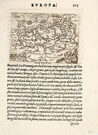
FAMILIA REGIA ab Holbenio picta.
by VERTUE, George.
- Used
- Condition
- Used
- Quantity Available
- 1
- Seller
-
London, United Kingdom
- Item Price
-
SGD 1,029.66SGD 20.59 shipping to USA
Show Details
Item Price
SGD 1,029.66
SGD 20.59
shipping to USA

FEMMES DE L'ILE DE SANTORIN. VUE PRISE AU VILLAGE DE NEBRIO À SANTORIN.: Pl. 17 & 18.
by CHOISEUL-GOUFFIER, Marie Gabriel F. A., Comte de.
- Used
- Condition
- Used
- Quantity Available
- 1
- Seller
-
London, United Kingdom
- Item Price
-
SGD 411.86SGD 20.59 shipping to USA
Show Details
Description:
Voyage Pittoresque de la Grece. Paris., 1782. A pair of pretty engravings of scenes from Santorini. The top one shows two women in a house sitting talking. The bottom is a view of a village looking out to sea. In 1776 Choiseul-Gouffier and the artist J.B. Hilaire joined a cartographic survey of the Mediterranean. Volume I of Voyage Pittoresque, his account of their tour of the Greek islands, the coast of Asia Minor, and of his travels on the mainland, was immediately acclaimed on publication in 1778. According to Brunet, it was incontestably the most beautiful production of this kind seen until then. Choiseul-Gouffier's work offered for the first time, illustrations of remote places that complemented the scrupulously researched narrative. Copper engraving. Uncoloured. Very good condition, despite small rust mark in top left margin, not affecting image. Good wide margins. Size: 22 x 33.5 cm. (8½ x 13 inches)
Item Price
SGD 411.86
SGD 20.59
shipping to USA

FEMMES DE L'ISLE DE SIPHANTO. VUE DE L'ISLE DE SIKINO.: Pl. 9 & 10.
by CHOISEUL-GOUFFIER, Marie Gabriel F. A., Comte de.
- Used
- Condition
- Used
- Quantity Available
- 1
- Seller
-
London, United Kingdom
- Item Price
-
SGD 205.93SGD 20.59 shipping to USA
Show Details
Description:
Voyage Pittoresque de la Grece. Paris., 1782. A pair of pretty engravings of scenes from two of the Cyclades islands. The top one shows two women, a toddler and a baby in a domestic scene on Sifnos. The bottom shows a lovely view from the sea of Sikinos. In 1776 Choiseul-Gouffier and the artist J.B. Hilaire joined a cartographic survey of the Mediterranean. Volume I of Voyage Pittoresque, his account of their tour of the Greek islands, the coast of Asia Minor, and of his travels on the mainland, was immediately acclaimed on publication in 1778. According to Brunet, it was incontestably the most beautiful production of this kind seen until then. Choiseul-Gouffier's work offered for the first time, illustrations of remote places that complemented the scrupulously researched narrative. Copper engraving. Uncoloured. Very good condition, despite a small tear on right margin not affecting image. Good wide margins. Size: 22 x 33.5 cm. (8½ x 13 inches)
Item Price
SGD 205.93
SGD 20.59
shipping to USA

FERRARIA.
by MERIAN, Matthew.
- Used
- Condition
- Used
- Quantity Available
- 1
- Seller
-
London, United Kingdom
- Item Price
-
SGD 377.54SGD 20.59 shipping to USA
Show Details
Description:
J.L. Gottfried's Archontologica Cosmica., 1649.. Handsome bird's eye view of Ferrara, with Po di Volano in the foreground. Key to the important buildings in the top right corner. This town plan was one of many engravings originally published in Merian's Theatrum Europaeum that were incorporated into later editions of Gottfried's chronicles. Copper engraving. Uncoloured. Very good condition, darkened centrefold. Size: 35 x 26 cm.
Item Price
SGD 377.54
SGD 20.59
shipping to USA

FIG.12
by MALLET, Alain Manesson.
- Used
- Condition
- Used
- Quantity Available
- 1
- Seller
-
London, United Kingdom
- Item Price
-
SGD 163.03SGD 20.59 shipping to USA
Show Details
Description:
Description de l'Univers., c1690. Interesting engraving from the French text edition of Description d'Univers by Alain Manneson Mallet (1630-1706), a well travelled military engineer and geographer who worked in 17th century France under King Louis XIV. Size: 110 x 150 mm. Copper engraving. Hand coloured. Fine condition.
Item Price
SGD 163.03
SGD 20.59
shipping to USA

FIG. 3.
by MALLET, Alain Manesson.
- Used
- Condition
- Used
- Quantity Available
- 1
- Seller
-
London, United Kingdom
- Item Price
-
SGD 163.03SGD 20.59 shipping to USA
Show Details
Description:
Description de l'Univers., c1690. Interesting engraving from the French text edition of Description d'Univers by Alain Manneson Mallet (1630-1706), a well travelled military engineer and geographer who worked in 17th century France under King Louis XIV. Size: 115 x150 mm. Copper engraving. Hand coloured. Fine condition.
Item Price
SGD 163.03
SGD 20.59
shipping to USA

FIRST STAGE OF CRUELY, SECOND STAGE OF CRUELY.
by HOGARTH, William
- Used
- Condition
- Used
- Quantity Available
- 1
- Seller
-
London, United Kingdom
- Item Price
-
SGD 163.03SGD 20.59 shipping to USA
Show Details
Description:
The Whole Works of William Hogarth. London., 1806.. Pair of Prints. Originally printed in 1751, each print depicts a different stage in the life of the fictional Tom Nero. Beginning with the torture of a dog as a child in the First stage of cruelty, Nero progresses to beating his horse as a man in the Second stage of cruelty. The prints were intended as a form of moral instruction; Hogarth was dismayed by the routine acts of cruelty he witnessed on the streets of London. Copper engraving. Uncoloured. Very good condition. Size: 33 x 40 cm. (13 x 15½ inches)
Item Price
SGD 163.03
SGD 20.59
shipping to USA
![[FIRTH OF FORTH].](https://d3525k1ryd2155.cloudfront.net/h/783/204/319204783.0.m.jpg)
[FIRTH OF FORTH].
by COLLINS, Capt. Greenvile
- Used
- Condition
- Used
- Quantity Available
- 1
- Seller
-
London, United Kingdom
- Item Price
-
SGD 858.05SGD 20.59 shipping to USA
Show Details
Description:
Great Britain Coasting Pilot., 1760. Sea chart of the Firth of Forth, showing the coast from Dunbar to St, Andrews. Soundings, rhumblines. Inset map of coast from St. Abb's Head to Berwick. Dedicatory cartouche at top left, decorated with spears, bannersmermaids and seamonsters, with scale in English miles below. The Great Britain Coasting Pilot was the result of the first systematic survey of British coastal waters. It took eight years to complete, and was used by the Royla Navy for navigating British waters for many years. The charts are notable for both their accuracy and their charm.Captain Greenvile Collins was an outstanding naval officer who became 'Hydrographer to the King' before the Coasting Pilot was published. Copper engraving. Later colour. Expert repairs to margins. Very good condition Size: 56.5 x 45 cm. (22 x 17½ inches) Tooley, Dictionary of Maps and Map Makers p.125; Moreland & Bannister, Antique Maps p.163
Item Price
SGD 858.05
SGD 20.59
shipping to USA

FLANDERS or the SPANISH NETHERLANDS with the archbishoprick of Cambresis
by MOLL, Herman.
- Used
- Condition
- Used
- Quantity Available
- 1
- Seller
-
London, United Kingdom
- Item Price
-
SGD 163.03SGD 20.59 shipping to USA
Show Details
Description:
London., 1744. Map of present day Belgium taken from Salmon's Modern History. Size: 260 x190 mm. Copper engraving. Later colouring. Fine condition, good margins.
Item Price
SGD 163.03
SGD 20.59
shipping to USA

FLANDERS or the SPANISH NETHERLANDS with the Archbishoprick of Cambresis and Bishoprick of Lyege.
by MOLL, Herman
- Used
- Condition
- Used
- Quantity Available
- 1
- Seller
-
London, United Kingdom
- Item Price
-
SGD 214.51SGD 20.59 shipping to USA
Show Details
Description:
Atlas Geographus., 1711-17. Attractive map of present day Belgium. Later colour. Library stamp slightly visible. Some minor offsetting. Copper engraving. Later colour. Fine condition, good margins. Size: 25.2 x 17.7 cm. (10 x 7 inches)
Item Price
SGD 214.51
SGD 20.59
shipping to USA

FLANDRIAE DESCRIPTIO.
by QUAD, Matthias.
- Used
- Condition
- Used
- Quantity Available
- 1
- Seller
-
London, United Kingdom
- Item Price
-
SGD 300.32SGD 20.59 shipping to USA
Show Details
Description:
Fascilus Geographicus., 1608. Decorative map of Flanders, with ornamental border, Latin text within strapwork border at lower right, scale at lower left, title and two coast of arms at upper left. Title cartouche to right of top centre. Matthaus Quad was a German cartographer based in Cologne, which, at the time was the centre for German cartography. This map is from his Fascilus Geographicus. It was printed by Johannes Bussemacher. Copper engraving. Original outline colour. Very good condition. Good margins. Rivers and a few place-names lightly outlined in brown and green. Size: 26.5 x 19 cm. (10 x 7 inches).
Item Price
SGD 300.32
SGD 20.59
shipping to USA
FLANDRIA
by BOTERO, Giovanni. Engraved by Ortelius.
- Used
- Condition
- Used
- Quantity Available
- 1
- Seller
-
London, United Kingdom
- Item Price
-
SGD 163.03SGD 20.59 shipping to USA
Show Details
Description:
RELATIONI UNIVERSALI DI GIOVANNI BOTERO BENESE., 1598. Giovanni Botero (1533-1617) was Secretary to the Duke of Savoy when he compiled his Relationi Universali; "this political and geographical description of the different countries of the world was very successful and translated into a number of languages" (Burden), including English (London 1603). Copper engraving. Uncoloured. Fine condition. map on sheet 20 x 15 cm. Map in Latin; accompanying text in Italian. Size: 11 x 8 cm. (4½ x 3 inches)
Item Price
SGD 163.03
SGD 20.59
shipping to USA

FLORENTISSIMUS RHENI PALATINATUS.: 32.
by QUAD, Matthias.
- Used
- Condition
- Used
- Quantity Available
- 1
- Seller
-
London, United Kingdom
- Item Price
-
SGD 248.83SGD 20.59 shipping to USA
Show Details
Description:
Fascilus Geographicus., 1608. A curious map of the Rheinland and Hessen regions of Germany. East appears to be to the right of the map, and west to the left, so Frankfurt for example is shown to the left of Meintz, and Bingen on the right when in fact they should be the other way round. Matthaus Quad was a German cartographer based in Cologne, which, at the time was the centre for German cartography. This map is from his Fascilus Geographicus. It was printed by Johannes Bussemacher. Copper engraving. Original colour. Overall good condition. Some show through from reverse, and old repair to top margin. Size: 27 x 21 cm. (10½ x 8½ inches)
Item Price
SGD 248.83
SGD 20.59
shipping to USA

FRANCE
by THOMSON, John
- Used
- Condition
- Used
- Quantity Available
- 1
- Seller
-
London, United Kingdom
- Item Price
-
SGD 334.64SGD 20.59 shipping to USA
Show Details
Description:
Edinburgh: , 1827. Handsome map of France, coloured by department. The New General Atlas was one of the most accurate and best produced atlases of its day. Copper engraving. Original outline colour. Fine condition. Size: 57.5 x 50 cm.
Item Price
SGD 334.64
SGD 20.59
shipping to USA

FRANCE
by ARROWSMITH, John.
- Used
- Condition
- Used
- Quantity Available
- 1
- Seller
-
London, United Kingdom
- Item Price
-
SGD 205.93SGD 20.59 shipping to USA
Show Details
Description:
London , 1834. Attractive map of France, coloured by departement, inset map to left 'Sktech of France divided into Provinces. John Arrowsmith constantly revised and improved his popular London Atlas and it ran to many editions. Copper engraving. Original colour. Some light offsetting. Very good condition. Size: 49 x 58.5 cm.
Item Price
SGD 205.93
SGD 20.59
shipping to USA

FRANCE
by LOWRY, J.W.
- Used
- Condition
- Used
- Quantity Available
- 1
- Seller
-
London, United Kingdom
- Item Price
-
SGD 471.93SGD 20.59 shipping to USA
Show Details
Description:
LONDON., 1858-63. Handsome map of France in outline colour, with inset map of France, showing the old provinces. Published in The Dispatch Atlas. Weekly Dispatch Lithograph. Original colour. Fine condition Size: 60 x 42 cm.
Item Price
SGD 471.93
SGD 20.59
shipping to USA

FRANCE DIVIDED INTO ITS PROVINCES.
by CARY, John.
- Used
- Condition
- Used
- Quantity Available
- 1
- Seller
-
London, United Kingdom
- Item Price
-
SGD 163.03SGD 20.59 shipping to USA
Show Details
Description:
New Universal Atlas., 1808.. This beautiful map, accurate and concise, is from John Cary's Universal Atlas. This was a compact version of his General Atlas, and shows the high standard of design, printing, and geographical accuracy that has led many to consider Cary as the finest of English map-makers. Copper engraving. Original colour. Fine condition. Size: 28 x 23 cm. (11 x 9 inches).
Item Price
SGD 163.03
SGD 20.59
shipping to USA

FRANCE in Provinces.
by SMITH, Charles.
- Used
- Condition
- Used
- Quantity Available
- 1
- Seller
-
London, United Kingdom
- Item Price
-
SGD 128.71SGD 20.59 shipping to USA
Show Details
Description:
New General Atlas., 1808.. Copper engraving. Original colour. Fine condition. Size: 33.5 x 26.5 cm. (13 x 10½ inches).
Item Price
SGD 128.71
SGD 20.59
shipping to USA

FRANCE in Provinces.
by THOMSON, John.
- Used
- Condition
- Used
- Quantity Available
- 1
- Seller
-
London, United Kingdom
- Item Price
-
SGD 300.32SGD 20.59 shipping to USA
Show Details
Description:
Edinburgh:, 1827. A handsome map of France, coloured by province. Thomson's The New General Atlas was one of the most accurate and best produced atlases of the day. Copper engraving. Original outline colour. Fine condition. Size: 57.5 x 50 cm.
Item Price
SGD 300.32
SGD 20.59
shipping to USA

FRANCIAE accurata descriptio. FRANKREICH mit seinen grentzen.
by QUAD, Matthias.
- Used
- Condition
- Used
- Quantity Available
- 1
- Seller
-
London, United Kingdom
- Item Price
-
SGD 557.73SGD 20.59 shipping to USA
Show Details
Description:
Fascilus Geographicus., 1608. Handsome map of France. Decorated cartouche at lower left. Matthaus Quad was a German cartographer based in Cologne, which, at the time was the centre for German cartography. This map is from his Fascilus Geographicus. It was printed by Johannes Bussemacher. Copper engraving. Uncoloured. Very good condition. Wide margins. Closed tears to lower centrefold have been neatly repaired. Some place-names, rivers and forests are highlighted in brown and green. Size: 27 x 19.5 cm. (10½ x 7½ inches).
Item Price
SGD 557.73
SGD 20.59
shipping to USA

Didn’t find what you’re looking for?
Try adding this search to your want list. Millions of books are added to our site everyday and when we find one that matches your search, we’ll send you an email. Best of all, it’s free.
Add to Want List

Are you a frequent reader or book collector?
Join the Bibliophile's Club and save 10% on every purchase, every day — up to $20 savings per order!

Social Responsibility
Did you know that since 2004, Biblio has used its profits to build 16 public libraries in rural villages of South America?
