Click for full-size.


The English Pilot for the Southern Navigation: Describing the Sea-Coasts, Capes, Headlands, Bays, Roads, Harbours, Rivers and Ports: together with the Soundings, Sands, Rocks and Dangers on the Coast of England, Scotland, Ireland, Holland, Flanders, Spain, Portugal, to the Streight’s- Mouth; with the Coasts of Barbary, and off to the Canary, Madeira, Cape de Verde and Western Islands Shewing the Courses and Distances from one place to another; The Setting of the Tides and Currents; the Ebbing and Flowing of the Sea, &c.
by SELLER, JOHN
- Used
- Condition
- See description
- Seller
-
CHELTENHAM, Gloucestershire, United Kingdom
Item Price
SGD 11,222.90
Or just SGD 11,188.37 with a
Bibliophiles Club Membership
Bibliophiles Club Membership
Ask Seller a Question
Payment Methods Accepted
About This Item
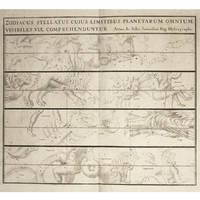
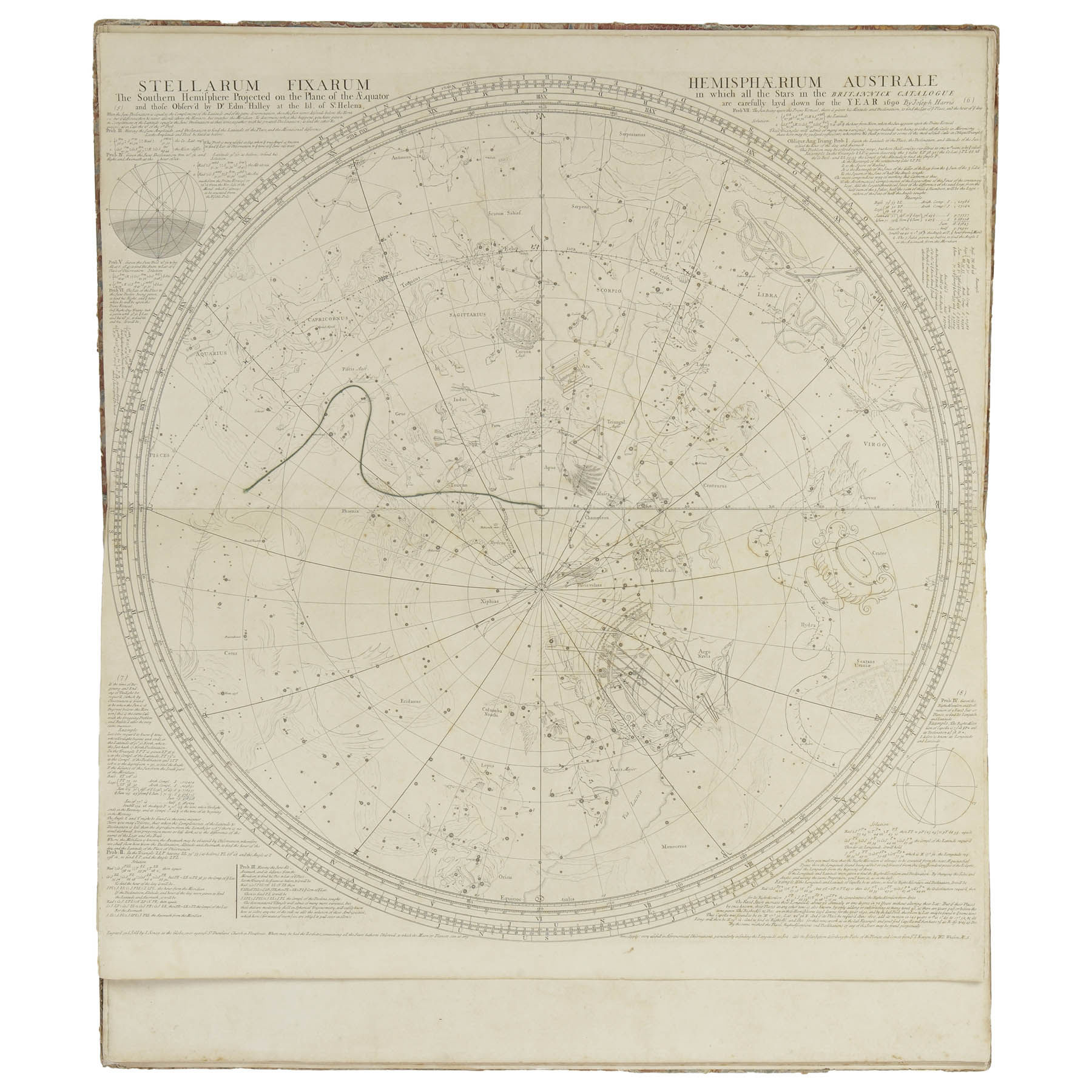
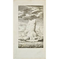
London: for Mount & Davidson on Towerhill, 1792, Folio [480 x 320mm], Contemporary Mottled Calf, Spine Gilt on Black, with 22 Double-Page and Folding Charts, 2 small charts, and numerous engravings of charts, navigational instruments, profiles, headlands throughout, small stain on title. A Very Fine Copy.
A Splendid example of this atlas with its series of stunning maps and charts and explicit sailing directions and notations. The charts describe the River Thames, Newcastle trade routes, the coastlines and various ports of England, Scotland, Ireland, Flanders and the Netherlands, France, Portugal, Spain, the Strait of Gibraltar, the Coast of Africa including the Canary Islands and the Cape Verde Islands.
Reviews
(Log in or Create an Account first!)
Details
- Seller
- Bruce Marshall Rare Books
 (GB)
(GB)
- Seller's Inventory #
- C516
- Title
- The English Pilot for the Southern Navigation: Describing the Sea-Coasts, Capes, Headlands, Bays, Roads, Harbours, Rivers and Ports: together with the Soundings, Sands, Rocks and Dangers on the Coast of England, Scotland, Ireland, Holland, Flanders, Spain, Portugal, to the Streight’s- Mouth; with the Coasts of Barbary, and off to the Canary, Madeira, Cape de Verde and Western Islands Shewing the Courses and Distances from one place to another; The Setting of the Tides and Currents; the Ebbing and Flowing of the Sea, &c.
- Author
- SELLER, JOHN
- Book Condition
- Used
- Quantity Available
- 1
- Publisher
- for Mount & Davidson on Towerhill
- Place of Publication
- London
- Date Published
- 1792
- Weight
- 0.00 lbs
- Keywords
- seller, atlas, navigation, canary islands,
- Size
- Folio [480 x 320mm]
Terms of Sale
Bruce Marshall Rare Books
30 day return guarantee, with full refund including original shipping costs for up to 30 days after delivery if an item arrives misdescribed or damaged.
About the Seller
Bruce Marshall Rare Books
Biblio member since 2020
CHELTENHAM, Gloucestershire
Ask Seller a Question
About Bruce Marshall Rare Books
Established in 1972 on the West Coast of Scotland, Bruce Marshall Rare Books began as specialists in rare and important books from 15th until 20th century.
Our particular specialities are fine natural history books, atlases & cartography, voyages & discovery, early illustrated books, important books in the history of science and astronomy, fine works from the Kelmscott Press, old engravings and photographs.
The books and manuscripts listed here are a selection of our stock.
Glossary
Some terminology that may be used in this description includes:
- Gilt
- The decorative application of gold or gold coloring to a portion of a book on the spine, edges of the text block, or an inlay in...
- Spine
- The outer portion of a book which covers the actual binding. The spine usually faces outward when a book is placed on a shelf....
- Fine
- A book in fine condition exhibits no flaws. A fine condition book closely approaches As New condition, but may lack the...
- Calf
- Calf or calf hide is a common form of leather binding. Calf binding is naturally a light brown but there are ways to treat the...
- Folio
- A folio usually indicates a large book size of 15" in height or larger when used in the context of a book description. Further,...

May the Fourth Be With You!
As the Star Wars franchise continues to grow, change, and churn out money-making film after film now under the control of Disney, we can bet that the desire to own Star Wars collectibles will also continue to grow. Check out our gallery of goodies from a galaxy far, far away...
Collecting and identifying signed letters and holographic documents
Many authors and other famous literary figures wrote and signed letters by hand, and you can find a great collection of them in the Biblio rare book room. See our great collection of handwritten letters and holographic documents
Also Recommended
-

-
-

-

-

Save 10% on every purchase!
Join the Bibliophiles’ Club and start saving 10% on every book.
$29.95 / Year
