Description:
London: Sherwood, Gilbert and Piper, 1830. Paperback in good condition. Publish date not printed, presume ca. 1830. Includes fold-out design by Telford for a suspension bridge over the River Avon (which was eventually constructed in 1865) and a fold-out colour map of the county. Covers are worn and creased at rear eges, spine ends are chipped and frayed. Light foxing to internal pages and leading corners are worn throughout. AD. Paperback. Good. Used.
Search Results: topographical and statistical description of the
You searched for:
- Title: topographical and statistical description of the
- Author: g a cooke
Results 1 - 20 of 23

Topographical and Statistical Description of the County of Somerset
by Cooke, G.A.
- Used
- good
- Paperback
- Condition
- Used - Good
- Binding
- Paperback
- Quantity Available
- 1
- Seller
-
Didcot, Oxfordshire, United Kingdom
- Item Price
-
SGD 25.82SGD 16.35 shipping to USA
Show Details
Item Price
SGD 25.82
SGD 16.35
shipping to USA
Topographical and Statistical Description of the County of Warwick.
by Cooke, G. A.
- Used
- very good
- Hardcover
- Condition
- Used - Very Good
- Binding
- Hardcover
- Quantity Available
- 1
- Seller
-
Sheffield, United Kingdom
- Item Price
-
SGD 51.63SGD 16.35 shipping to USA
Show Details
Description:
London.: Sherwood, Neely, and Jones. Undated, circa early 1800s. 180pp, four engravings on two plates (foxed), county map (slightly spotted), index. Later boards & endpapers.. Hardcover. Very Good. 16mo - over 5¾" - 6¾" tall.
Item Price
SGD 51.63
SGD 16.35
shipping to USA

A Topographical and Statistical Description of the County of Surrey
by Cooke, G A
- Used
- good
- Hardcover
- Condition
- Used - Good
- Edition
- new edition
- Binding
- Hardcover
- Quantity Available
- 1
- Seller
-
Llanwrda, Carmarthenshire, United Kingdom
- Item Price
-
SGD 58.43SGD 29.17 shipping to USA
Show Details
Description:
Sherwood, Gilbert & Piper, 1830. Book. Good. Hardcover. new edition. an undated copy but that of 1830, small 8vo, later parchment binding preserving original pictorial card covers, parchment much darkened, paper title to spine, original card cover frayed to edges and with the signature of a previous owner at head, paper rubbed to corners, fold-out map in colours with a short closed tear, b&w frontis, a double page of four views heavily foxed, bookplate of a previous owner on front pastedown, tightly bound and text unmarked and clean, 178 pages and Index..
Item Price
SGD 58.43
SGD 29.17
shipping to USA
A Topographical and Statistical Description of the County of Cumberland
by Cooke, G A
- Used
- Hardcover
- Condition
- Used
- Binding
- Hardcover
- Quantity Available
- 1
- Seller
-
Lincoln, Lincolnshire, Aberdeen, United Kingdom
- Item Price
-
SGD 66.99SGD 21.94 shipping to USA
Show Details
Description:
London: Sherwood, Jones & Co, NULL. A Complete County Itinerary. 2nd edition. 8 views on 4 pages. Folding map. Bound with The Lakes of Cumberland. No publication date circa 1820. Bound in half leather with original marble boards. Cover slightly scuffed. Some foxing on plates. .Hardback,Ex-Library,with usual stamps markings,with previous owner's name inside cover,in fair to good all-round condition,no dust jacket. With 4 pages of plates, 180 pp, X pages and 136 pp of the Lakes. Please note the Image in this listing is a stock photo and may not match the covers of the actual item,300grams, ISBN:
Item Price
SGD 66.99
SGD 21.94
shipping to USA
TOPOGRAPHICAL AND STATISTICAL DESCRIPTION OF THE COUNTY OF: NOTTINGHAM containing an account of its situation, extent, towns, roads, rivers, minerals, fisheries, manufacturers, commerce, agriculture...to which is prefixed a copius travelling guide...forming a complete county itinerary...
by COOKE G A
- Used
- good
- Hardcover
- Condition
- Used - Good
- Binding
- Hardcover
- Quantity Available
- 1
- Seller
-
SALISBURY, Wiltshire, United Kingdom
- Item Price
-
SGD 68.84SGD 27.45 shipping to USA
Show Details
Description:
G Brimmer. Good. G Brimmer c1804 140pp pocket size hardback rebound in green, hand-coloured map of Nottinghamshire, hinges slightly exposed, slightly foxing in places otherwise g
Item Price
SGD 68.84
SGD 27.45
shipping to USA

More Photos
A Topographical and Statistical Description of the County of Lancaster
by G. A. Cooke
- Used
- Paperback
- Condition
- Used - Good Only
- Binding
- Paperback
- Quantity Available
- 1
- Seller
-
BATH, Somerset, United Kingdom
- Item Price
-
SGD 77.45SGD 20.57 shipping to USA
Show Details
Description:
London: Sherwood, Neely, and Jones, 1830. Paperback. Good Only. 6" by 4". Not Stated. A scarce topographical study of Lancaster, from British academic George Albert Cooke. With a folding map. Scarce work. Dated from the Society of Antiquaries of London Library. Illustrated with one folding map and four plates. A topographical study on Lancaster, with statistical descriptions, and an account of the various towns, rivers, lakes, fisheries, trades, mines, agriculture, and curiosities both natural and historical. Written by George Albert Cooke, a British Anglican clergyman and academic. In the original paper wraps. Externally, worn with shelf wear and minor chipping to the extremities. Front board detached with tape to the edge from previous attempt to repair. Rear board held by cords only. Light loss to the head and tail of the spine. Internally, generally firmly bound with some pages loosening. Pages are bright with the odd handling mark. Good Only
Item Price
SGD 77.45
SGD 20.57
shipping to USA
Topographical and Statistical description of the County of Lincoln
by Cooke, G.A.
- Used
- Hardcover
- Condition
- Used
- Binding
- Hardcover
- Quantity Available
- 1
- Seller
-
Great Leighs, Essex, United Kingdom
- Item Price
-
SGD 51.63SGD 49.91 shipping to USA
Show Details
Description:
Published by sherwood, Neely and Jones, London, nd (c1818 from text references). Black leather spine, marbled paper covered boards. ""Lincoln"" in gilt to spine. 5.5ins x 3.5ins, 144pp plus folding map and 2pp plates with 4 images. Previous owners name to corner of front pastedown. Stain to front pastedown. Slight loss of leather to top of spine. contents VG.
Item Price
SGD 51.63
SGD 49.91
shipping to USA

More Photos
Topographical and Statistical Description of the Principality of Wales. Part I. North Wales; Containing and account of its situation, extent, towns, roads, rivers, lakes, mines, minerals, , fisheries, manufactures, trade, commerce, agriculture, fairs, markest, curiosities, antiquities, natural history, civil and ecclesiastical jurisdiction, &c. to Which is Prefixed a Copious Travelling Guide Exhibiting the Direct and Principal Cross Roads, Inns, Distances of Stages and Noblemen's and Gentlemen's Seats; with a List of the Fairs and an index table, shewing, at one view, the distances of all the towns from London and of the towns to each other.
by Cooke, G.A.
- Used
- good
- Hardcover
- Condition
- Used - Good
- Edition
- Second Edition
- Binding
- Hardcover
- Quantity Available
- 1
- Seller
-
Lower Hutt, Auckland, New Zealand
- Item Price
-
SGD 68.80SGD 37.15 shipping to USA
Show Details
Description:
London: Sherwood, Neely and Jones Book. Good. Half-Leather. Second Edition. 24mo - over 5 - 5¾" tall. no publication date, ca, 1830s. 231 pages plus index, folding map, 4 engarvimngs on 2 plates. Frontcover is detached..
Item Price
SGD 68.80
SGD 37.15
shipping to USA
Topographical and Statistical Description of the County of Gloucester; ...A Copious Travelling Guide;... Forming A Complete County Itinerary.
by Cooke, G. A.
- Used
- Hardcover
- Condition
- Used - , the book bumped at corners, upper board is scuffed, lower board grazed, tail of spine is a little pulled, small piece missing
- Edition
- Early Edition
- Binding
- Hardcover
- Quantity Available
- 1
- Seller
-
Skipton, North Yorkshire, United Kingdom
- Item Price
-
SGD 77.45SGD 34.42 shipping to USA
Show Details
Description:
, [4] 180 pages, 10 plates comprising 2 folding maps (one of which is frontispiece) of Gloucestershire and Herefordshire and 8 black and white half page plates, index at the rear of the book
Item Price
SGD 77.45
SGD 34.42
shipping to USA

A Topographical and Statistical Description of the County of Surrey
by Cooke, G A
- Used
- very good
- Hardcover
- Condition
- Used - Very Good
- Binding
- Hardcover
- Quantity Available
- 1
- Seller
-
Llanwrda, Carmarthenshire, United Kingdom
- Item Price
-
SGD 96.38SGD 29.17 shipping to USA
Show Details
Description:
Sherwood, Neely, and Jones, 1816. Book. Very Good. Hardcover. an undated copy printed between 1815 and 1820, 12mo, later half green morocco lettered gilt to spine, marbled paper covered boards, a later binding preserving the carefully repaired soiled paper cover of the original, rubbed with mild loss to bottom corner of first few pages, map printed in colours, signature of a previous owner on front free endpaper, text clean and unmarked, binding tight, a well preserved copy, Tables, 178pp & Index.
Item Price
SGD 96.38
SGD 29.17
shipping to USA

More Photos
Topographical and Statistical Description of the Principality of Wales
by G. A. Cooke
- Used
- very good
- Hardcover
- first
- Condition
- Used - Very Good
- Edition
- First edition
- Binding
- Hardcover
- Quantity Available
- 1
- Seller
-
BATH, Somerset, United Kingdom
- Item Price
-
SGD 111.87SGD 20.57 shipping to USA
Show Details
Description:
London: Sherwood, Neely, and Jones, c1818. First edition. Cloth. Very Good. 6" by 3.5". Not Stated. A scarce first edition of this topographical study of North Wales. First edition of the work, in a quarter cloth binding with marbled boards. Dated from reference to ground levelling in 1817, as stated on page 106.Written by G. E. Cooke, this topographical work contains statistics and descriptions on the principality of North Wales. With information on aspects such as the towns, roads, rivers, mines and antiquities of the area. Part one only. Lacking part two covering South Wales.Cooke has also included a 'Copious Travelling Guide' exhibiting the direct main roads, the inns and distances of stages and the noblemen's seats of the region. With the distances of all the towns from one another and from London. With a folding map of the principality to the front of the work and four illustrations of North Wales before the title page. Collated, complete. With a library bookplate for the University College…
Read More Item Price
SGD 111.87
SGD 20.57
shipping to USA
A Topographical and statistical description of the County of Buckingham and Berks [2 Volumes in one]
by Cooke, G. A. ESQ.
- Used
- Hardcover
- first
- Condition
- Used - , corners lightly rubbed, plates foxed, maps shadowed, spine sunned, first plate taped in, pages clean, small book binder's labe
- Edition
- Second Edition and first edition
- Binding
- Hardcover
- Quantity Available
- 1
- Seller
-
Skipton, North Yorkshire, United Kingdom
- Item Price
-
SGD 103.27SGD 34.42 shipping to USA
Show Details
Description:
, 176, [4], 179 pages, 4 plates containing 8 engravings, 2 folding maps
Item Price
SGD 103.27
SGD 34.42
shipping to USA
More Photos
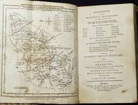
A Topographical and Statistical Description of the County of Northampton: . . . To which is prefixed, a Copious Travelling Guide . . . Forming a Complete County Itinerary; Also, a list of the Fairs; And an Index Table . . . by George Alexander Cooke
by Cooke, G. A. (George Alexander)
- Used
- Hardcover
- Condition
- Used - Very Good -
- Binding
- Hardcover
- Quantity Available
- 1
- Seller
-
Lansdowne, Pennsylvania, United States
- Item Price
-
SGD 134.86SGD 6.47 shipping to USA
Show Details
Description:
London: Printed for C. Cooke by G. Brimmer, and sold by all the booksellers in the United Kingdom, 1816. Hardcover. Very Good -. "Illustrated with a Map of the County." 12, 142, [4] p., 1 folded leaf of a map of Northamptonshire: tables; 15 cm. Contemporary half red leather with marbled paper over boards. Modern sensitive rebacking with matching leather and Japanese tissue repair of hinges. First 12 pages are publisher's catalog of Sherwood, Neely, and Jones. Final 2 pages contain publisher's catalog of Cooke's Elegant Pocket Editions. No year of publication. The publisher Charles Cooke died in 1816; his catalog was then sold by Sherwood, Neely, and Jones. The absence of "by assignment from the executor of the late C. Cooke" on the title page indicates that this was printed but not yet sold when Cooke died and subsequently offered by Sherwood, Neely, and Jones with their catalog added. In Very Good- Condition: boards are rubbed; modern leather rebacking;…
Read More Item Price
SGD 134.86
SGD 6.47
shipping to USA

More Photos
A Topographical and Statistical Description of the County of Wilts; Containing an Account of its Situation, Extent, Towns, Roads, Rivers, Lakes, Mines, Minerals, Fisheries, Manufactures, Trade, Commerce, Agriculture, Fairs, Markets, Curiosities, Antiquities, Natural History, Civil and Ecclesiastical Jurisdictions, &C. To which is prefixed, a Copious Travelling Guide, Exhibiting the Direct and Principal Cross Roads, Inns, Distances of Stages, and Noblemen's and Gentlemen's Seats. Also, a List of the Markets and Fairs, and an Index Table, Shewing, at one View, the Distances of all the Towns from London, and of Towns from each other; the Whole Forming a Complete County Itinerary
by G. A. Cooke
- Used
- good
- Hardcover
- Condition
- Used - Good
- Binding
- Hardcover
- Quantity Available
- 1
- Seller
-
BATH, Somerset, United Kingdom
- Item Price
-
SGD 120.48SGD 20.57 shipping to USA
Show Details
Description:
London: Sherwood & Co, 1830. Leather. Good. 5.5" by 3.5". Not Stated. A new edition of this detailed and popular travel guide to Wiltshire, written by George Alexander Cooke. Illustrated throughout, including with a colour folding map. A new edition of this work.Illustrated with a frontispiece, a colour folding map, and two plates.Collated, complete.Undated, dated from Jisc from a copy held at the London Library.A concise topographical guide to Wiltshire, discussing the country in great detail.The work offers information on various aspects of the county, including the towns, roads, markets, agriculture, and more, including the distances of the prominent towns from London and from each other.Part of 'Cooke's Topographical Library', which was also called 'British Traveller's Pocket County Directory'.Written by George Alexander Cooke, who is known for his many topographical publications similar to this volume. In a half calf binding with marbled paper to the boards. Externally, generally smart, with…
Read More Item Price
SGD 120.48
SGD 20.57
shipping to USA
A TOPOGRAPHICAL AND STATISTICAL DESCRIPTION OF THE COUNTY OF WILTS. Containing an Account of Its Situation, Extent, Towns, Roads, Rivers, Lakes, Mines, Minerals, Fisheries, Manufacturies, Trade, Commerce, Agriculture, Fairs, Markets, Curiosities Etc
by Cooke, G. A
- Used
- Hardcover
- Condition
- Used - Good+
- Binding
- Hardcover
- Quantity Available
- 1
- Seller
-
Penzance, Cornwall, United Kingdom
- Item Price
-
SGD 120.48SGD 24.10 shipping to USA
Show Details
Description:
Paternoster Row, London: Sherwood, Neely and Jones. Full-Leather. Good+. Title continues " Antiquities, Natural History, Civil & Ecclesiatical Juridiction &c. To Which is Prefixed a Copious Travelling Guide.&c.which form a Complete County Itinerary; with a list of Fairs and an Index Table. Illustrated with a Map of the County." Double-Page Frontispiece Illustrated with 4 Engraved Views, Fonthill; Bradford; Wardour; Stourton Church. Complete with Folding Map of the County. Contemporary Full-Leather Binding with Gilt Title on Red ground to spine. Gilt Decorative border to front and rear board. Undated Edition, probably very early 19th Century. Attractive antique Heraldic Bookplate on Endpaper "White" family. 144 Pages, 120 Pages, 5 3/4" Tall. Small piece of leather missing from top of spine (1/2"). Fine splits to leather down sides of spine. Some edge wear to cover. Some Browning to Illustrations. Pages in very good, clean condition. Please ask if you would…
Read More Item Price
SGD 120.48
SGD 24.10
shipping to USA

More Photos
A Topographical And Statistical Description Of The County Of Hants : Containing An Account Of Its Situation, Extent, Towns, Roads, Rivers, Lakes, Mines, Minerals, Fisheries, Manufactures, Trade, Commerce, Agriculture, Fairs, Markets, Curiosities, Antiquities, Natural History, Civil And Ecclesiastical Jurisdictions, &c : To Which Is Prefixed A Copious Travelling Guide Exhibiting The Direct And Principal Cross Roads, Inns And Distance Of Stages, And Noblemen's And Gentleman's Seats Forming A Complete County Itinerary. Also, A List Of The Fairs ; And An Index Table, Shewing, At One View, The Distances Of All Towns From London, and From Each Other
by Cooke, G A [ George Alexander ]
- Used
- Hardcover
- Condition
- Used
- Edition
- reprint.
- Binding
- Hardcover
- Quantity Available
- 1
- Seller
-
Newbury, Berkshire, United Kingdom
- Item Price
-
SGD 137.69SGD 18.05 shipping to USA
Show Details
Description:
printed, by Assignment from the executors of the late G Cooke for Sherwood, Neely & Jones, Paternoster Row, 1819. reprint.. Hardback. Modern cloth, F. 144pp, 2 engraved plates showing 4 views, folding engraved map, a fine copy in a neatmodern cloth binding. A single volume from Cooke's 'The Modern British Traveller, Or, Tourist's Pocket Directory', which was published c 1802 - 1817 and which eventually ran to 47 volumes covering the whole of Britain.
Item Price
SGD 137.69
SGD 18.05
shipping to USA
Topographical and Statistical Description of the county of Buckingham. Cornwall Cheshire
by Cooke, George Alexander G.A.:
- Used
- Hardcover
- Condition
- Used
- Binding
- Hardcover
- Quantity Available
- 1
- Seller
-
Cley-Next-The-Sea, Norfolk, United Kingdom
- Item Price
-
SGD 103.27SGD 60.24 shipping to USA
Show Details
Description:
Printed for C. Cooke circa 1807 Topographical and Statistical Descriptions. 3 volumes in 1 - Buckinghamshire, Cornwall and Cheshire. Small HB, 9.5x14cms, marbled boards, cloth spine. Buckinghamshire - folding map, 155pp, 2pp illustrations. This is followed by 2pp Cornwall illustrations, title page 'Topography of Great Britain Vol 1 Cornwall and Devon', xii preface, folding map of England and Wales. Then the Cornwall section - folding map, 168pp. Cheshire - folding map, 2pp illustrations, 135pp. Spine rubbed and worn, boards rubbed. Some inked notations to front pastedown, previous owner's signature and address to fep. Some scattered foxing throughout and some occassional dark marks to top margins. Still a VG copy.
Item Price
SGD 103.27
SGD 60.24
shipping to USA

A Topographical and Statistical Description of the County of Devon: Containing an Account of its Situation, Extent, Towns, Roads, Rivers... To which is Prefixed, a Copious Travelling Guide... Forming a Complete County Itinerary. Also, a List of the Markets and Fairs..
by COOKE, G.A.
- Used
- Hardcover
- Condition
- Used
- Binding
- Hardcover
- Quantity Available
- 1
- Seller
-
Lewes, East Sussex, United Kingdom
- Item Price
-
SGD 129.08SGD 46.47 shipping to USA
Show Details
Description:
London: Printed for Sherwood, Neely, and Jones, [c.1820].. Third edition. 12mo. 316, (8) pp. Contemporary tan half calf over marbled boards, spine with raised bands, gilt lettered black label. Frontispiece folding map with original outline colour plus two illustrations in the text.
Item Price
SGD 129.08
SGD 46.47
shipping to USA
Topographical and Statistical Description of the County of Gloucester etc etc to Which is Prefixed a Copious Travel Guide a complete county itinerary, with a list of the fairs, and an index Table BOUND TOGETHER WITH Topographical and Statistical Description of the County of Hereford to Which is Prefixed a Copious Travelling Guide Exhibiting the Direct and Principal Cross Roads Inns Distances of Stages and Noblemens & Gentlemens Seats also List of Markets & Fairs Added to Which is a Topographical and Statistical Descriptions of the County of Worcester. A New Edition.
by COOKE, G. A.
- Used
- Condition
- Used
- Quantity Available
- 1
- Seller
-
Hay-on-Wye, Herefordshire, United Kingdom
- Item Price
-
SGD 129.08SGD 51.63 shipping to USA
Show Details
Description:
(c. 1830). Sherwood & Co. London. No date c.1830. Two Volumes bound in one. Both New Editions. Gloucester: 178 pages + [2]pp index, engraved frontis., fold-out hand-coloured map, folding engraving of Telford's design for suspension bridge plus one other engraved plate. Worcester: 180 pages. Engraved frontis. plus fold-out hand-coloured map. Ex-ref library from the city of York. Bound in quarter brown calf gilt with new endpapers, stamps to reverse of folding plates and to plate. Pages browned otherwise a clean and sound volume.
Item Price
SGD 129.08
SGD 51.63
shipping to USA
Topographical and Statistical Description of the County of Sussex.
by Cooke, G. A.
- Used
- Hardcover
- Condition
- Used
- Binding
- Hardcover
- Quantity Available
- 1
- Seller
-
Alfriston, Aberdeen, United Kingdom
- Item Price
-
SGD 146.29SGD 43.89 shipping to USA
Show Details
Description:
C. Cooke, London. No date (circa early 1800s).. Hardback.. Hand-coloured folding map frontis. Handsomely rebound with buckram spine and marbled-effect paper-covered boards. Minor staining and foxing to map and title page. Very Good.
Item Price
SGD 146.29
SGD 43.89
shipping to USA

Didn’t find what you’re looking for?
Try adding this search to your want list. Millions of books are added to our site everyday and when we find one that matches your search, we’ll send you an email. Best of all, it’s free.
Add to Want List

Are you a frequent reader or book collector?
Join the Bibliophile's Club and save 10% on every purchase, every day — up to $20 savings per order!

Social Responsibility
Did you know that since 2004, Biblio has used its profits to build 16 public libraries in rural villages of South America?
