Geography from Andre Strong Bookseller
New Arrivals

TAIGA, TUNDRA & TIDAL An Introduction to Maitoba's Coastal Region
- Condition
- Used - Very Good
- Jacket Condition
- No Jacket
- Edition
- 1st Edition
- Published
- 1968
- Binding
- Soft cover
- Quantity Available
- 1
- Seller
-
Blue Hill, Maine, USA
- Item Price
-
SGD 15.11
Show Details
Description:
Manitoba Dept. of Renewable Resources and Transportation Services, 1968. 1st Edition. Soft cover. Very Good/No Jacket. 8 1/2 in. x 11 in. high. 32 pages. Condition of book is VERY GOOD; Very light shelf-wear to covers. Text is very clean. 0.0 Item Price
SGD 15.11
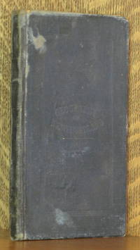
GEOGRAPHY OF NEWFOUNDLAND FOR THE USE OF SCHOOLS
by William Pilot
- Condition
- Used - Good +
- Edition
- First edition
- Published
- c. 1908
- Binding
- Hardcover
- Quantity Available
- 1
- Seller
-
Blue Hill, Maine, USA
- Item Price
-
SGD 68.68
Show Details
Description:
London: William Collins Sons and Co., c. 1908. First edition. Hardcover. Good +. 5 x 7 in. 64 pp. Green cloth boards. Condition is GOOD ; covers quite worn with creasing to rear board cloth. Front hinge is started with muslin visible but not broken. Color frontis map has lost it's lower half, Text has a few slight… Read more about this item Item Price
SGD 68.68
More Photos
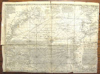
A NEW CHART OF THE VAST ATLANTIC OCEAN EXHIBITING THE SEAT OF WAR, BOTH IN EUROPE AND AMERICA...
by Emanuel Bowen
- Condition
- Used - Very Good
- Edition
- First edition
- Published
- 1740
- Binding
- Map
- Quantity Available
- 1
- Seller
-
Blue Hill, Maine, USA
- Item Price
-
SGD 240.40
Show Details
Description:
London: London Magazine, 1740. First edition. Map. Very Good. 12 1/2 x 17 1/2 inches. This map was originally published in London Magazine in 1740. Printed at top center 'A Table Comparing this Chart with Mr. Popples Great Map of the British Empire in America'. Condition is Very Good; light vertical crease at center fold, a few small… Read more about this item Item Price
SGD 240.40
More Photos
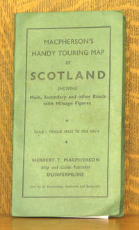
MACPHERSON'S NEW HANDY MAP OF SCOTLAND - FOR MOTORISTS, CYCLISTS AND TOURISTS. SCALE, 12 MILES TO ONE INCH. SHOWING MAIN, SECONDARY OND OTHER ROADS WITH MILEAGE FIGURES
by Herbert T. Macpherson
- Condition
- Used - Very Good
- Binding
- Paperback
- Quantity Available
- 1
- Seller
-
Blue Hill, Maine, USA
- Item Price
-
SGD 20.61
Show Details
Description:
Dunfermline UK: Herbert T. Macpherson. Paperback. Very Good. 4 x 7 inches, 20 x 25 inches unfolded. No date, 1950s? Condition is Very Good, one small tear at a fold otherwise excellent. STK Item Price
SGD 20.61
More Photos
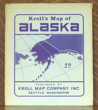
KROLL'S MAP OF ALASKA
by Kroll
- Condition
- Used - Very Good +
- Published
- c 1960
- Binding
- Paperback
- Quantity Available
- 1
- Seller
-
Blue Hill, Maine, USA
- Item Price
-
SGD 20.61
Show Details
Description:
Seattle WA: Kroll Map Company, c 1960. Paperback. Very Good +. 38 x 43 inches, folds to 9 1/2 x 11 inches. No date but text on back of envelope mentions 1959 statehood. Price is $2.95. In original envelope. Condition of the map is Very Good+, looks new, colors vibrant, very clean and unmarked, no tears. Envelope is… Read more about this item Item Price
SGD 20.61
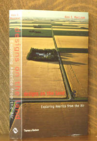
DESIGNS ON THE LAND EXPLORING AMERICA FROM THE AIR
by Ales MacLean
- Condition
- Used - Very Good +
- Edition
- First American edition
- Published
- 2003
- Binding
- Paperback
- ISBN
- 9780500284148
- Quantity Available
- 1
- Seller
-
Blue Hill, Maine, USA
- Item Price
-
SGD 20.61
Show Details
Description:
New York: Thames and Hudson, 2003. First American edition. Paperback. Very Good +. 7 x 10 in. Paper wraps. Condition is VERY GOOD+ ; mild edge wear, covers clean. Binding tight and text unmarked. Geog. Stax. Item Price
SGD 20.61
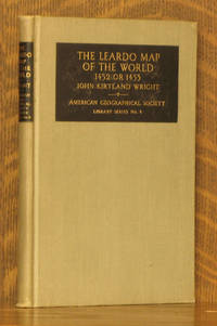
THE LEARDO MAP OF THE WORLD - 1452 OR 1453
by John Kirtland Wright, A.B. Hoen
- Condition
- Used - Very Good
- Edition
- First edition
- Published
- 1928
- Binding
- Hardcover
- Quantity Available
- 1
- Seller
-
Blue Hill, Maine, USA
- Item Price
-
SGD 20.61
Show Details
Description:
New York: American Geographical Society, 1928. First edition. Hardcover. Very Good. 5 x 7 1/2 inches. 74 pages + 10 maps. Condition is Very Good, corners lightly bumped, text and illustrations are very clean, binding is tight. STK Item Price
SGD 20.61
NATURAL ADVANCED GEOGRAPHY
by Jacques Redway
- Condition
- Used - Good +
- Published
- 1901
- Binding
- Hardcover
- Quantity Available
- 1
- Seller
-
Blue Hill, Maine, USA
- Item Price
-
SGD 27.47
Show Details
Description:
New York: American Book Co., 1901. Hardcover. Good +. 10 x 13 in. Cloth boards have been covered with old wallpaper. Condition is GOOD+ ; edges worn, covers have some water stains. Binding strong and text unmarked. Color maps. Item Price
SGD 27.47
![ORDNANCE SURVEY ONE-INCH MAP OF GREAT BRITAIN - IPSWICH [NATIONAL GRID SEVENTH SERIES] SHEET 150](https://d3525k1ryd2155.cloudfront.net/h/266/597/851597266.0.m.jpg)
ORDNANCE SURVEY ONE-INCH MAP OF GREAT BRITAIN - IPSWICH [NATIONAL GRID SEVENTH SERIES] SHEET 150
by Ordnance Survey
- Condition
- Used - Very Good
- Published
- 1956
- Binding
- Paperback
- Quantity Available
- 1
- Seller
-
Blue Hill, Maine, USA
- Item Price
-
SGD 20.61
Show Details
Description:
Chessington: Ordnance Survey, 1956. Paperback. Very Good. 5 x 8 1/2 inches. Condition is Very Good; Very clean with no markings. STK Item Price
SGD 20.61
A LITERARY & HISTORICAL ATLAS OF ASIA
by J. G. Bartholomew
- Condition
- Used - Very Good
- Published
- c 1920
- Binding
- Hardcover
- Quantity Available
- 1
- Seller
-
Blue Hill, Maine, USA
- Item Price
-
SGD 61.82
Show Details
Description:
London & New York: J.M. Dent & Sons/ E.p. Dutton & Co., c 1920. Hardcover. Very Good. 4 1/2 x 7 inches. xi, 226 pages. No date c. 1920. Condition is Very Good; Spine slightly faded, pevios owner's name, dated 1923, on half title page, text and illustrations are very clean, binding is tight. STK Item Price
SGD 61.82
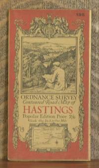
ORDNANCE SURVEY CONTOURED ROAD MAP OF HASTINGS Popular edition Scale 1 inch to 1 mile- Sheet # 135
by Ordnance Survey
- Condition
- Used - Very Good
- Edition
- Third revised edition
- Published
- 1921
- Binding
- Map
- Quantity Available
- 1
- Seller
-
Blue Hill, Maine, USA
- Item Price
-
SGD 27.47
Show Details
Description:
Southampton: Ordnance Survey Office/ Charles Close Dir., 1921. Third revised edition. Map. Very Good. 4 X 7 in. high. unfolds to 30 X 21 inches. Condition of the book is VERY GOOD; Map is very clean, lightly rubbed at folds, but no splits or tears. Geography Ephemera Item Price
SGD 27.47
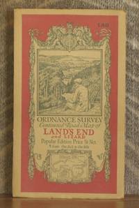
ORDNANCE SURVEY CONTOURED ROAD MAP OF LAND'S END AND LIZARD Popular edition Scale 1 inch to 1 mile- Sheet # 146
by Ordnance Survey
- Condition
- Used - Very Good
- Edition
- Third revised edition
- Published
- 1931
- Binding
- Map
- Quantity Available
- 1
- Seller
-
Blue Hill, Maine, USA
- Item Price
-
SGD 27.47
Show Details
Description:
Southampton: Ordnance Survey Office/ Charles Close Dir., 1931. Third revised edition. Map. Very Good. 4 X 7 in. high. unfolds to 34 1/2 X 28 inches. Condition of the book is VERY GOOD; Map is very clean, lightly rubbed at folds, but no splits or tears. Geography Ephemera Item Price
SGD 27.47
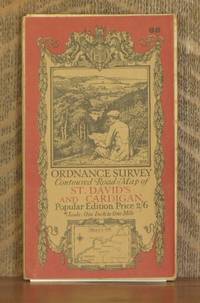
ORDNANCE SURVEY CONTOURED ROAD MAP OF ST. DAVID'S AND CARDIGAN Popular edition Scale 1 inch to 1 mile- Sheet # 88
by Ordnance Survey
- Condition
- Used - Very Good
- Published
- 1923
- Binding
- Map
- Quantity Available
- 1
- Seller
-
Blue Hill, Maine, USA
- Item Price
-
SGD 27.47
Show Details
Description:
Southampton: Ordnance Survey Office/ E.M. Jack Dir., 1923. Map. Very Good. 4 X 7 in. high. unfolds to 36 X 23 1/2 inches. Condition of the book is VERY GOOD; Map is very clean, lightly rubbed at folds, but no splits or tears. Geography Ephemera Item Price
SGD 27.47
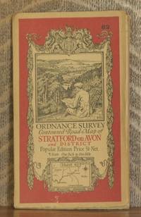
ORDNANCE SURVEY CONTOURED ROAD MAP OF STRATFORD-on-AVON AND DISTRICT Popular edition Scale 1 inch to 1 mile- Sheet # 82
by Ordnance Survey
- Condition
- Used - Very Good
- Edition
- Third revised edition
- Published
- 1930
- Binding
- Map
- Quantity Available
- 1
- Seller
-
Blue Hill, Maine, USA
- Item Price
-
SGD 27.47
Show Details
Description:
Southampton: Ordnance Survey Office/ Charles Close Dir., 1930. Third revised edition. Map. Very Good. 4 X 7 in. high. unfolds to 29 1/2 X 22 inches. Condition of the book is VERY GOOD; Map is very clean, lightly rubbed at folds, but no splits or tears. Geography Ephemera Item Price
SGD 27.47
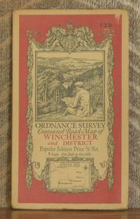
ORDNANCE SURVEY CONTOURED ROAD MAP OF WINCHESTER AND DISTRICT Popular edition Scale 1 inch to 1 mile- Sheet # 123
by Ordnance Survey
- Condition
- Used - Very Good
- Edition
- Third revised edition
- Published
- 1931
- Binding
- Map
- Quantity Available
- 1
- Seller
-
Blue Hill, Maine, USA
- Item Price
-
SGD 27.47
Show Details
Description:
Southampton: Ordnance Survey Office/ Charles Close Dir., 1931. Third revised edition. Map. Very Good. 4 X 7 in. high. unfolds to 29 1/2 X 22 inches. Condition of the book is VERY GOOD; Map is very clean, lightly rubbed at folds, but no splits or tears. Geography Ephemera Item Price
SGD 27.47
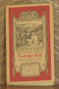
ORDNANCE SURVEY CONTOURED ROAD MAP OF TUNBRIDGE WELLS Popular edition Scale 1 inch to 1 mile- Sheet # 125
by Ordnance Survey
- Condition
- Used - Very Good
- Edition
- Third revised edition
- Published
- 1930
- Binding
- Map
- Quantity Available
- 1
- Seller
-
Blue Hill, Maine, USA
- Item Price
-
SGD 27.47
Show Details
Description:
Southampton: Ordnance Survey Office/ Charles Close Dir., 1930. Third revised edition. Map. Very Good. 4 X 7 in. high. unfolds to 29 1/2 X 22 inches. Condition of the book is VERY GOOD; Map is very clean, lightly rubbed at folds, but no splits or tears. Geography Ephemera Item Price
SGD 27.47
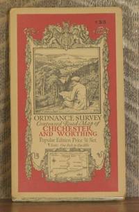
ORDNANCE SURVEY CONTOURED ROAD MAP OF CHICHESTER AND WORTHING Popular edition Scale 1 inch to 1 mile- Sheet # 133
by Ordnance Survey
- Condition
- Used - Very Good
- Edition
- Third revised edition
- Published
- 1929
- Binding
- Map
- Quantity Available
- 1
- Seller
-
Blue Hill, Maine, USA
- Item Price
-
SGD 27.47
Show Details
Description:
Southampton: Ordnance Survey Office/ Charles Close Dir., 1929. Third revised edition. Map. Very Good. 4 X 7 in. high. unfolds to 29 1/2 X 22 inches. Condition of the book is VERY GOOD; Map is very clean, lightly rubbed at folds, but no splits or tears. Geography Ephemera Item Price
SGD 27.47
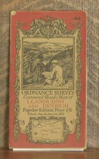
ORDNANCE SURVEY CONTOURED ROAD MAP OF LLANDUDNO AND DENBIGH Popular edition Scale 1 inch to 1 mile- Sheet # 42
by Ordnance Survey
- Condition
- Used - Very Good
- Edition
- Third revised edition
- Published
- 1928
- Binding
- Map
- Quantity Available
- 1
- Seller
-
Blue Hill, Maine, USA
- Item Price
-
SGD 27.47
Show Details
Description:
Southampton: Ordnance Survey Office/ Charles Close Dir., 1928. Third revised edition. Map. Very Good. 4 X 7 in. high. unfolds to 30 X 25 inches. Condition of the book is VERY GOOD; Map is very clean, lightly rubbed at folds, but no splits or tears. Geography Ephemera Item Price
SGD 27.47

ORDNANCE SURVEY CONTOURED ROAD MAP OF SIDMOUTH AND BRIDPORT Popular edition Scale 1 inch to 1 mile- Sheet # 139
by Ordnance Survey
- Condition
- Used - Very Good
- Published
- 1924
- Binding
- Map
- Quantity Available
- 1
- Seller
-
Blue Hill, Maine, USA
- Item Price
-
SGD 27.47
Show Details
Description:
Southampton: Ordnance Survey Office/ Charles Close Dir., 1924. Map. Very Good. 4 X 7 in. high. unfolds to 30 X 21 inches. Condition of the book is VERY GOOD; Map is very clean, lightly rubbed at folds, but no splits or tears. Geography Ephemera Item Price
SGD 27.47

ORDNANCE SURVEY CONTOURED ROAD MAP OF PEMBROKE AND TENBY Popular edition Scale 1 inch to 1 mile- Sheet # 99
by Ordnance Survey
- Condition
- Used - Very Good
- Edition
- Third revised edition
- Published
- 1930
- Binding
- Map
- Quantity Available
- 1
- Seller
-
Blue Hill, Maine, USA
- Item Price
-
SGD 27.47
Show Details
Description:
Southampton: Ordnance Survey Office/ Charles Close Dir., 1930. Third revised edition. Map. Very Good. 4 X 7 in. high. unfolds to 38 X 24 1/2 inches. Condition of the book is VERY GOOD; Map is very clean, lightly rubbed at folds, but no splits or tears. Geography Ephemera Item Price
SGD 27.47
