Maps from Lord Durham Rare Books (IOBA)
New Arrivals

More Photos
Map of part of Labrador illustrating the proposed northern boundary of the Province of Quebec
by LOW, A. P. (Albert Peter), [1861-1942] contributor & MCGEE, John J. (John Joseph), [1845-1927]
- Condition
- Used - Good
- Edition
- 1st Edition
- Published
- 1896
- Binding
- No binding
- Quantity Available
- 1
- Seller
-
St. Catharines, Ontario, CAN
- Item Price
-
SGD 617.80
Show Details
Description:
[Ottawa]: Department of Interior, Lithographic Office (A. P. Low, Surveyor, D. E. V Eaton, Cart.), 1896. 1st Edition. No binding. Good. SCARCE AND IMPORTANT QUEBEC & LABRADOR COLOURED MAP First edition. 29,3 x 90,7 cm on a folded sheet of 17 x 39 inches. Bar scale in miles. Shows rivers and lakes, trails, some geographical names between James… Read more about this item Item Price
SGD 617.80

More Photos
Orographical Map of the Dominion of Canada and Newfoundland
by Department of Mines and Resources
- Condition
- Used - Very Good
- Published
- 1931
- Binding
- No binding
- Quantity Available
- 1
- Seller
-
St. Catharines, Ontario, CAN
- Item Price
-
SGD 137.29
Show Details
Description:
Ottawa: Department of Mines and Resources, Surveys and Engineering Branch, Hydrographic and Map Service, 1931. No binding. Very Good. Flat size: 32 x 25-1/2 inches. Folded size: 16 x 13 inches. Very good condition.An orographical map of the Dominion of Canada and Newfoundland from 1931. Relief is shown by gradient tints, hachure, and spot heights. Mountain ranges are… Read more about this item Item Price
SGD 137.29

More Photos
Chart of the World showing New Route through Canada between England, China, Japan, Australasia and the East
by JOHNSON, J. (John) & JOHNSON, George (1837-1911)
- Condition
- Used
- Jacket Condition
- Fair
- Edition
- 1st Edition
- Published
- 1886
- Binding
- No binding
- Quantity Available
- 1
- Seller
-
St. Catharines, Ontario, CAN
- Item Price
-
SGD 102.97
Show Details
Description:
[Ottawa]: Department of Agriculture, Canada Bank Note, 1886. 1st Edition. No binding. Fair. First edition. 46-1/2 x 28 inches unfolded.. Now folded with many closed tears from folds, recent scotch tape in the back on a few joints. Fair condition. Published by order of the Hon. John Carling, M.P., Minister of Agriculture. Department of Agriculture, Ottawa, Canada, April… Read more about this item Item Price
SGD 102.97

More Photos
Practical notes made during a tour in Canada, and a portion of the United States, in MDCCCXXXI
by FERGUSSON, Adam (1873-1862) & BLACKWOOD, William, (1776-1834) & MOFFAT, J. (engraver)
- Condition
- Used - Very Good
- Edition
- 2nd Edition
- Published
- 1834
- Binding
- Hard Cover
- Quantity Available
- 1
- Seller
-
St. Catharines, Ontario, CAN
- Item Price
-
SGD 1,029.68
Show Details
Description:
London: William Blackwood, 1834. 2nd Edition. Hard Cover. Very Good. IMPORTANT EARLY CANADA EMIGRATION BOOK WITH RARE MAP 2nd edition.4 x 6-1/2 inches. [iii]-xvi, 426pp.[1], plus folding map in front pocket.19th-century polished calf, gilt, spine gilt extra, leather label stamped in gilt. Minor soiling, corners worn. Contemporary bookplate. Internally clean. Map backed on linen. Bottom birder small tear… Read more about this item Item Price
SGD 1,029.68

More Photos
Carte de la Riviere de Richelieu et du Lac Champlain
by BELLIN, Jacques Nicolas [1703-1772] (cartographer)
- Condition
- Used - Good
- Edition
- 1st Edition
- Published
- 1744
- Binding
- No binding
- Quantity Available
- 1
- Seller
-
St. Catharines, Ontario, CAN
- Item Price
-
SGD 171.61
Show Details
Description:
[Paris], 1744. 1st Edition. No binding. Good. First Edition. Paper flat size: 5-5/8 x 7-3/4 inches to the neat-line with right border having #7 sideways. Was folded, now flat and has been cleaned and deacidified, with 1/4 x 3-3/4 inch top right border lacking, otherwise, good condition. Engraver Desbruslins stated.Copper engraved map of the Richelieu River, Lake Champlain… Read more about this item Item Price
SGD 171.61

More Photos
Carte du fonds de la Baye de Hudson, que les Anglois appellent Baye James
by BELLIN, Jacques Nicolas [1703-1772] (cartographer)
- Condition
- Used - Good
- Edition
- 1st Edition
- Published
- 1744
- Binding
- No binding
- Quantity Available
- 1
- Seller
-
St. Catharines, Ontario, CAN
- Item Price
-
SGD 137.29
Show Details
Description:
[Paris], 1744. 1st Edition. No binding. Good. First Edition. Paper flat size: 5-5/8 x 7-3/4 inches to the neat-line with right border having #38 sideways. Was folded, now flat and has been cleaned and deacidified, with 1/4 x 3-3/4 inch top right border lacking, otherwise, good condition. Engraver Desbruslins stated.Copper engraved map. Covers area of James Bay, the… Read more about this item Item Price
SGD 137.29

More Photos
Carte des Bayes, Rades et Port de Plaisance dans l'Ile de Terre Neuve
by BELLIN, Jacques Nicolas [1703-1772] (cartographer) & DHEULLAND, Guillaume [1700-1770] (engraved by)
- Condition
- Used - Good
- Edition
- 1st Edition
- Published
- 1744
- Binding
- No binding
- Quantity Available
- 1
- Seller
-
St. Catharines, Ontario, CAN
- Item Price
-
SGD 137.29
Show Details
Description:
[Paris], 1744. 1st Edition. No binding. Good. First edition. Map of the Bay, Harbour and Port of Placentia on the Island of Newfoundland.Paper flat size: 11-1/4 x 7-3/4 inches to the neat-line with right border having #2 sideways. Was folded, now flat and has been cleaned and deacidified, with some very light offsetting on the bottom and 3/8… Read more about this item Item Price
SGD 137.29

More Photos
Carte de la Baye de Hudson. Par N. Bellin Ingenieur de la Marine
by BELLIN, Jacques Nicolas [1703-1772] (cartographer)
- Condition
- Used - Good
- Edition
- 1st Edition
- Published
- 1744
- Binding
- No binding
- Quantity Available
- 1
- Seller
-
St. Catharines, Ontario, CAN
- Item Price
-
SGD 130.43
Show Details
Description:
[Paris], 1744. 1st Edition. No binding. Good. First Edition. Paper flat size: 11-1/2 x 8-1/4 inches to the neat-line with right border having #3 sideways. Was folded, now flat and has been cleaned and deacidified, with 1/2 x 4-1/4 inch top left border lacking, four very small hole on bottom border repaired, otherwise, good condition. Engraved by Dheulland.Kershaw… Read more about this item Item Price
SGD 130.43

More Photos
Plan de la Riviere du Saguenay. Lacs, Rivières & Ruisseaux, ainsi que la qualité du sol du Terrein et des Bois situés de chaque côté de la dite Riviere du Saguenay, fait d'apres une Esquise et Informations données par Pascal Taché ecuier
by Larue, A. (Arpenteur) & SMILLIE, James Jr. [1807-1885] (engraved by) & SAX, William
- Condition
- Used - Good
- Edition
- 1st Edition
- Published
- 1827
- Binding
- No binding
- Quantity Available
- 1
- Seller
-
St. Catharines, Ontario, CAN
- Item Price
-
SGD 617.80
Show Details
Description:
Published by J. Smillie, 1827. 1st Edition. No binding. Good. French text. Plan of the Saguenay River. Lakes, Rivers & Streams, as well as the quality of the soil of the Terrein and the Woods located on either side of the said River of Saguenay, made according to an Esquise and Information given by Pascal Taché ecuier, Lord… Read more about this item Item Price
SGD 617.80

More Photos
Maps, Reports, Estimates &c, relative to Improvements of the Navigation of the River St. Lawrence and a proposed Canal connecting the River St. Lawrence and Lake Champlain. Laid before the Legislative Assembly during the 2nd Session, 5th Parliament, 1856
by CHABOT, Jean (1806-1860)
- Condition
- Used - Very Good
- Edition
- 1st Edition
- Published
- 1856
- Binding
- Hard Cover
- Quantity Available
- 1
- Seller
-
St. Catharines, Ontario, CAN
- Item Price
-
SGD 549.16
Show Details
Description:
Toronto: Published by John Lovell, 1856. 1st Edition. Hard Cover. Very Good. First edition, scarce. 20 x 14 in. 40 pages. Original leather spine and corners with gilt type on worn cloth cover. Inside pages are in very good condition with small pin holes old library name O.F.M. Québec on three of the 40 text pages. With a… Read more about this item Item Price
SGD 549.16

More Photos
Ontario Kingston Sheet 10 S.W. Canada, Department of Mines and Resources Surveys and Engineering Branch Hydrographic and Map Service
by Surveyor General and Chief Hydrographic Service
- Condition
- Used - Good
- Edition
- 1st Edition
- Published
- 1937
- Binding
- No binding & hard cover
- Quantity Available
- 1
- Seller
-
St. Catharines, Ontario, CAN
- Item Price
-
SGD 171.61
Show Details
Description:
Ottawa: Published in at the office of the Surveyor General and Chief Hydrographic Service, 1937. 1st Edition. No binding & hard cover. Good. SCARCE TYPOGRAPHICAL MAP OF KINGSTON AREAOntario Kinston Sheet, Leeds and portions of Lennox and Addington, Frontenac Lanark and Grenville Counties. Showing Counties, Townships Cities Towns over and under 4,000 population boundries, Railways and Canals. Standard… Read more about this item Item Price
SGD 171.61
More Photos
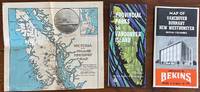
3 Vancouver, Victoria BC related maps
by Various
- Condition
- Used - Very Good
- Published
- 1977
- Binding
- No binding
- Quantity Available
- 1
- Seller
-
St. Catharines, Ontario, CAN
- Item Price
-
SGD 137.29
Show Details
Description:
1977. No binding. Very Good. 1) Victoria and Island Touring Map. Circa 1925. Scarce. Victoria and Island Publicity Bureau (Publisher) Colonist Lithograph (Printer). Quite scarce promotional map, showing the roads and cruise ship lines in and around the Vancouver Island area. Promotional advertising on the verso. Shows major highways and ferry routes on Vancouver Island, lower mainland B.C.,… Read more about this item Item Price
SGD 137.29

More Photos
Tourist Map of Canada
by Canadian National Railways
- Condition
- Used - Good
- Edition
- Very early edition
- Published
- 1938
- Binding
- No binding
- Quantity Available
- 1
- Seller
-
St. Catharines, Ontario, CAN
- Item Price
-
SGD 102.97
Show Details
Description:
[Montreal]: Canadian National Railways, 1938. Very early edition. No binding. Good. The map contains info about the main tourist destinations in Canada.Folded size: 4-1/8 x 9-1/4 inchesFlat size: 18-1/2 x 32 inches.A couple of fold minor holes, otherwise very good condition. Aerial photographs of Halifax, Quebec City, Montreal; Jasper Park, the Inner Harbor of Victoria, Vancouver, important buildings,… Read more about this item Item Price
SGD 102.97

More Photos
Plan du Port Dauphin et de sa rade avec l'entrée de Labrador
by BELLIN, Jacques Nicolas [1703-1772]
- Condition
- Used - Good
- Edition
- 1st Edition
- Published
- 1744
- Binding
- No binding
- Quantity Available
- 1
- Seller
-
St. Catharines, Ontario, CAN
- Item Price
-
SGD 116.70
Show Details
Description:
1744. 1st Edition. No binding. Good. First edition. Copper engraved map. Image size to neat line: 11-1/4 x 7-7/8 inches Saint Anns Bay (N.S.). Port Dauphin is now Englishtown on Cape Breton island, Victoria Province, Nova Scotia. This map also has an inset view of "Fort Dauphin". The fort is "planned for defense of the harbor entry of… Read more about this item Item Price
SGD 116.70

More Photos
Carte du Detroit entre le Lac Superieur et le Lac Huron, ave le Sault Sainte Marie et la Poste de Michillimakinac, Dresse sur les Manuscrits du Depot des Cartes et Plans de la Marine
by BELLIN, Jacques Nicolas [1703-1772] & DHEULLAND, Guillaume [1700-1770] (engraved by)
- Condition
- Used - Good
- Edition
- 1st Edition
- Published
- 1744
- Binding
- No binding
- Quantity Available
- 1
- Seller
-
St. Catharines, Ontario, CAN
- Item Price
-
SGD 164.75
Show Details
Description:
Paris: Chez Rolin, 1744. 1st Edition. No binding. Good. First edition. Copper engraved map. Image size to neat line: 6-1/4 x 8-7/8 inches. Small map of the strategic passage in the Upper Lakes system, which was so important to the colonial fur trade. Map details the region between Lake Superior and Lake Huron. Starting at Whitefish Bay &… Read more about this item Item Price
SGD 164.75

Braddock's defeat Field of Battle 1755
by SHAFFNER, Taliaferro Preston (1818-1881)
- Condition
- Used - Very Good
- Published
- 1863
- Binding
- No binding
- Quantity Available
- 1
- Seller
-
St. Catharines, Ontario, CAN
- Item Price
-
SGD 20.59
Show Details
Description:
1863. No binding. Very Good. Braddock's field of battle plan British defeat near Fort Du Quesne. Image 9 x 5.5 inches (23x14cm). Steel engraving. Very good condition. from Taliaferro Preston Shaffner's History of the United States, Plate V Drawn and engraved for 'Shaffner's History of the United States' by W.W. Woolley. Circa 1863. Item Price
SGD 20.59

More Photos
Geographical, Statistical, And Historical Map Of Upper And Lower Canada, And The Other British Possessions In North America. British Possessions In North America
by LUCAS, Fielding Jr. [1781-1854] & YOUNG & DELLEKER
- Condition
- Used - Very Good
- Published
- 1823
- Binding
- No binding
- Quantity Available
- 1
- Seller
-
St. Catharines, Ontario, CAN
- Item Price
-
SGD 102.97
Show Details
Description:
Philadelphia: H.C. Carey & I. Lea, 1823. No binding. Very Good. Paper size 17.5 x 22 wide, text & image size 16-1/2 x 20-1/4 inches and actual map image size (map border) : 9-1/4 x 13-1/2 inches. Hand-colored map surrounded by statistical data, 'Geographical, Statistical and Historical Map of Upper and Lower Canada, and the Other British Possessions… Read more about this item Item Price
SGD 102.97

More Photos
Atlas du traité de grandes opérations militaires, par le colonel Jomini, employé de Sa Majesté l'Empereur Napoléon
by JOMINI, Antoine Henri, baron de (1779-1869)
- Condition
- Used - Good-
- Edition
- 1st Edition
- Published
- 1807
- Binding
- Hard Cover
- Quantity Available
- 1
- Seller
-
St. Catharines, Ontario, CAN
- Item Price
-
SGD 130.43
Show Details
Description:
Paris: Giguet et Michaud, 1807. 1st Edition. Hard Cover. Good-. ATLAS OF THE TREATY OF MAJOR MILITARY OPERATIONS BY COLONEL JOMINI First edition. 8 x 10⁻¹/2 inches. With large engraved 'Carte Generale Pour l'Intelligence de la Guerre de Sept-Ans' and related Battle Plans for Lowositz, Prague, Kollin, Roisbach, Breslau, lagemdorf, Leuthen, Zomdorf, Hohenkirch, Cunersdorf, Minden, Zullichau, Maxen, Landshut,… Read more about this item Item Price
SGD 130.43

More Photos
Isles de la Reine Charlotte - map of Queen Charlotte Island on James Cook journey
by BELLIN, Jacques Nicolas [1703-1772]
- Condition
- Used - Very Good
- Published
- 1785
- Binding
- No binding
- Quantity Available
- 1
- Seller
-
St. Catharines, Ontario, CAN
- Item Price
-
SGD 48.05
Show Details
Description:
1785. No binding. Very Good. 40 X 23cm (16" X 9 1/2"), Folded (as issued) Some age toning, small old water stain marks along top 2 inches and foldings from the book. Good condition.Tilted "Isles de la reine charlotte. Der Konigin Charlotte Inseln" Jacques Nicolas Bellin was a French hydrographer, geographer, and member of the French intellectual group… Read more about this item Item Price
SGD 48.05

More Photos
Carte du Golphe de St-Laurent et Pays voisins pour servir à l'Histoire Générale des Voyages
by BELLIN, Jacques Nicolas [1703-1772]
- Condition
- Used - Good
- Edition
- 1st, 2nd issue
- Published
- 1780
- Binding
- No binding
- Quantity Available
- 1
- Seller
-
St. Catharines, Ontario, CAN
- Item Price
-
SGD 137.29
Show Details
Description:
France: (Histoire des Voyages), 1780. 1st, 2nd issue. No binding. Good. First edition, 2nd state. Paper size: 15-1/2 x 10 inches Image size: 14-1/4 x 8-3/4 inches. Copper-engraved map, hand colouring in outline. Gulf of Saint Lawrence area. Hand colored antique map of the Gulf of Saint Lawrence showing is the outlet of North America's Great Lakes via… Read more about this item Item Price
SGD 137.29
