
Click for full-size.
U. S. Geographical Surveys West of the 100th Meridian: Topographical Atlas Sheets: Portfolio of Seven Maps: Colorado, New Mexico and Arizona
by George M. Wheeler
- Used
- Acceptable
- Condition
- Acceptable/Unjacketed
- Seller
-
Cazenovia, New York, United States
Payment Methods Accepted
About This Item
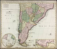
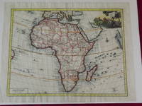
A rare portfolio of 7 maps published by United States Government Printing Office in 1876. This copy is ex library, the portfolio quarter bound case as shown with this listing is rubbed, bumped and the cloth spine is frayed. The maps are as shown, some have crease tears and light tanning but otherwise are in reasonable condition. The maps are as follows: Central Colorado, Atlas sheet no. 61 (B)/Southwestern Colorado, Atlas sheet 61 C/S. W. Colorado, San Juan mining region, Atlas sheet # 61(C)/North Central New Mexico, Atlas sheet # 69(D)/Parts of Central and Western Arizona, Atlas sheet # 75/Parts of Eastern Arizona and Western New Mexico, Atlas sheet # 76/Parts of Eastern and South Eastern Arizona, Western & South Western New Mexico, Atlas sheet no. 83. Your purchase helps our small public library. pi (B1)
Reviews
(Log in or Create an Account first!)
Details
- Seller
- Friends of the Cazenovia Public Library
 (US)
(US)
- Seller's Inventory #
- 2735
- Title
- U. S. Geographical Surveys West of the 100th Meridian: Topographical Atlas Sheets
- Author
- George M. Wheeler
- Format/Binding
- Portfolio of Maps
- Book Condition
- Used - Acceptable
- Jacket Condition
- Unjacketed
- Quantity Available
- 1
- Publisher
- United States Government Printing Office
- Place of Publication
- Washington DC
- Date Published
- 1876
- Pages
- 7 Maps
- Size
- 6.25 x 9.25
- Weight
- 0.00 lbs
- Keywords
- Geographical Surveys
- Bookseller catalogs
- Topographic.; US Maps; Geographical Surveys;
Terms of Sale
Friends of the Cazenovia Public Library
Return guarantee with full refund, including shipping costs, for up to 14 days after delivery if an item arrives misdescribed or damaged.
About the Seller
Friends of the Cazenovia Public Library
Biblio member since 2018
Cazenovia, New York
About Friends of the Cazenovia Public Library
We are a group of volunteers supporting our local library. All proceeds go to the library. We strive for excellent customer service. Please contact us with any questions. If you are in the area you may also visit our store, Carriage Barn Books, adjacent to the library at 100 Albany Street Cazenovia NY
Glossary
Some terminology that may be used in this description includes:
- Cloth
- "Cloth-bound" generally refers to a hardcover book with cloth covering the outside of the book covers. The cloth is stretched...
- New
- A new book is a book previously not circulated to a buyer. Although a new book is typically free of any faults or defects, "new"...
- Spine
- The outer portion of a book which covers the actual binding. The spine usually faces outward when a book is placed on a shelf....
This Book’s Categories

Storing books - laying down or standing up?
Don’t unwittingly damage your growing book collection! Learn about when to store books laying down vs standing up. Read About Safe Book Storage
Also Recommended
-

-
-
-
-

Save 10% on every purchase!
Join the Bibliophiles’ Club and start saving 10% on every book.
$29.95 / Year